Old Ross River
Last Wednesday we (the school) all went over to the Old Ross River town site for Kaska Day, where we partook in a variety of cultural activities plus a little tour of the Old Ross River lead by a local elder.
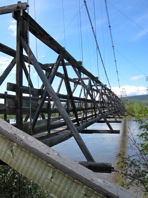
Suspension Foot Bridge that links the two sides of the river together.
This suspension foot bridge was built during the 1940's to allow for the transportation of oil from Norman Wells NWT to Whitehorse, YT.
With the bombing of Pearl Harbor in 1941, and the targeting of American oil refineries in the Aleutian Islands, the American government began to worry about their Alaskan oil supply being cut off by the Japanese. In May 1942 they began construction of an oil pipeline and service road that was to carry crude oil from Norman Wells to a refinery in Whitehorse. It took two years to complete and was shut down at the end of the war, only one year after it became operational.
When the order came to close the project, many soldiers simply abandoned
their vehicles on the side of the road, some with the keys still in the
ignition. The rusting shells of army jeeps and other equipment can still be seen along the Canol road (one such vehicle is at the Welcome to Ross River sign).
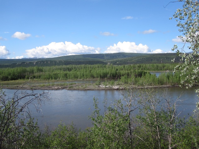
The Pelly River

The Path to Old Ross River (there is also a road that takes you to the site).
Old Ross River was settled by the Kaska during the early 1900's and were joined by other First Nations groups that, elders think, were escaping conflict in other areas of the Yukon due to the Gold Rush.

Although no longer standing, this was the site of the first trading post in Ross River (circa 1902).

One of the few remaining structures in Old Ross River.


Where the Pelly River and Ross River join

Kennie and the Pelly River

Old Greenhouse Frame

Old house in Old Ross River
During the 1960's the Canadian Government along with the Canadian Military uprooted the whole community and moved it from the Northern banks of the Pelly River to the Southern banks of the Pelly River (its current location) so that the community would be more accessible to government workers and services.

Split Tree along the path to Old Ross River
![]()
2 comments:
Great pictured Kendra. I was wondering when you would get the chance to post some up. Other than the mountains, the land their looks similar to what it does here. The erosion in the 7th photo bears a striking resemblance to parts of the shore of the Athabasca River where we cross over from our subdivision to get to the downtown core.
Yeah, a lot of the "mountains" here bear the same erosion patterns. Where I am, I call them hills instead of mountains, but I have been corrected many times. Once you head back southward towards BC the 'real' mountains begin to appear again.
And, with any luck, I will be posting more regularly .... hopefully... depending on how crazy things get again in September with a new group of students. But, I am aiming for at least once a week :-)
Post a Comment